Calling all land trusts, county governments, cities, towns, and villages!
We welcome you to add information about permanently protected lands that do not currently appear on NYPAD. If you are a land trust, municipality, or county that holds conserved open space—either land held in fee or subject to a conservation easement—sharing information on protected land can help us better track the progress of 30x30. Help us by completing this five-minute form: Submit Data
Background:
NYPAD is an essential resource for tracking New York State's permanently protected lands, and a planning tool for state agencies, organizations, and individuals working to conserve New York State's lands and waters. It also supports 30x30, the State's initiative to conserve thirty percent of lands and waters by 2030. The data in NYPAD can be viewed in the interactive map, or downloaded for use with a mapping application (such as ArcGIS Pro, or QGIS). Limited attribute information about an area is available in the interactive map. Full attribute information is available in the downloaded data.
Not all lands in NYPAD are open to the public - "protected" is not the same as "open." Inclusion in NYPAD does not imply permission for the public to enter that area – many lands in NYPAD are not publicly accessible. We do not provide information on public access in this map viewer. Assume any protected area included in NYPAD is closed to the public until you verify it is open by contacting the managing organization or consulting their website for information on public access and other rules regarding use of the area.
Data on protected areas have been collected from state, federal, and local governments; private conservation organizations and land trusts; and colleges and universities. Efforts to identify other sources of protected area data, and to obtain the data and incorporate it into NYPAD’s geodatabase, are ongoing. Maintenance of the data is also ongoing; updates will be made as new parcels are protected and as more accurate spatial data becomes available.
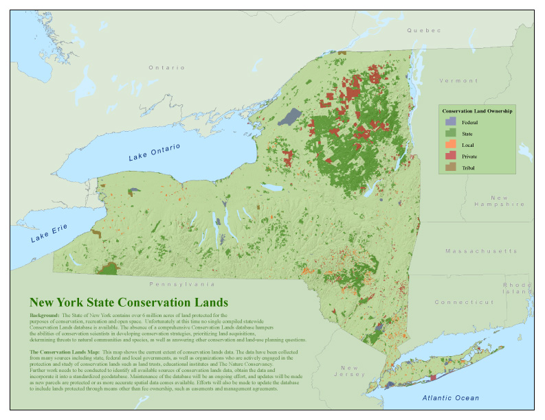
New York Protected Areas Map:This map shows the protected lands in New York State currently included in NYPAD. Explore in more detail on the NYPAD Interactive Map |
|